Do you know how to describe your position on the Earth? One way would be to give your street address. For example:
1060 West Addison Street
Chicago, Illinois 60613
United States of America
But, what if you were constantly on the move? Or, what if you were in the middle of the ocean? In that case, you couldn’t give a street address, but you could still identify your position using your coordinates on the surface of the earth, known as your longitude and latitude.
Latitude is measured in degrees north or south of the Equator. The Equator is an imaginary line at 0° latitude. The North Pole is at 90° North, and the South Pole is at 90° South.
The picture below shows a map of the Earth. The center of the map, just off the coast of Africa, is the point where the Equator and the Prime Meridian meet.
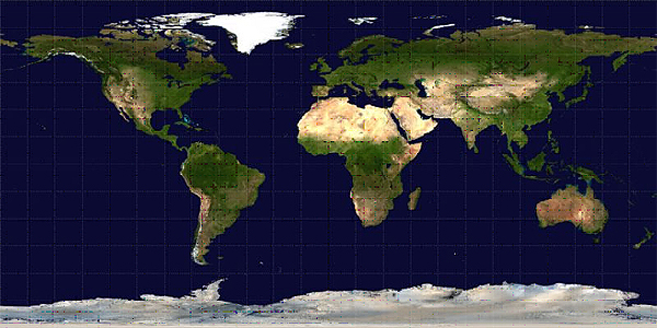
Explore 1. Your teacher will give you a full-page copy of this map. Cut off all the white space around the edges, then wrap it into a cylinder and tape the two short sides together. You have just made a very simple model of the Earth.
Question 1. Compare your simple model of the Earth to a globe, which is another model of the Earth. How are the two models similar and different?
Question 2. The flat map is a two-dimensional model, and the globe is a three-dimensional model. Which type of model is better for modeling the Earth? Why do you think that might be?